


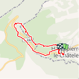

14.8 km | 23 km-effort

User


FREE GPS app for hiking
 SityTrail
IGN / Geographical institutes
SityTrail World
The world is yours!
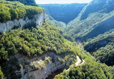
Trail Walking of 3.6 km to be discovered at Bourgogne-Franche-Comté, Doubs, Les Premiers-Sapins. This trail is proposed by Delmasjacques.


Walking

Walking
Walking
Walking

On foot

Walking
Walking
Walking
Walking
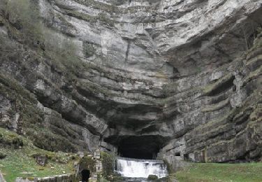
superbe, néanmoins pas si facile que ça, tout est question d'entraînement et de point de vue. la montée tout comme la descente sont assez raides. très beaux panoramas en tout cas, je recommande.